OpenTopoMap is a topographic map out of data from OpenStreetMap and SRTM. If you are interested in building your own OpenTopoMap, see the beginner's guides for a tile server and for Garmin files.
The main OpenTopoMap is a online rendered raster map. It can be used with the web interface on https://opentopomap.org, which gives you nice features like a search function or loading your gpx tracks. Futhermore, OpenTopoMap can be included into other applications. See https://opentopomap.org/about#verwendung for information on usage. The license of the online map is CC-BY-SA.
The online renderer is based on Mapnik. All necessary files are available to build your own OpenTopoMap server. Please note, that the old raster tiles are depreciated. OpenTopoMap will switch to vector tiles.
New vector tiles will be generated via tilemaker and are based on a modified shortbread scheme.
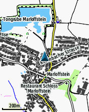
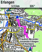
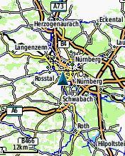
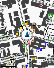
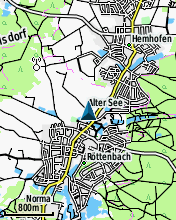
Since summer 2014 there is a Garmin edition of the OpenTopoMap. They can be downloaded from http://garmin.opentopomap.org. The license of the Garmin maps is CC-BY-NC-SA and therefore reselling is not allowed. Here are some screenshots: